

Remnants of Tropical Storm Beta to bring days of rain to north Georgia
ATLANTA - All of north Georgia has been enjoying a taste of fall the past few days, but it's about to abruptly come to an end.
The remnants of Beta, which is now a tropical depression, are causing flooding and severe weather across the ARK-LA-TEX region and the storm system is slowly moving towards north Georgia.
The greatest impact our area will see will be the potential for localized flooding. Thankfully, it looks like the greatest risk for severe storms, including spin-up tornadoes, will be south of our viewing area.
Rain chances will remain limited through sun rise Thursday and then start to increase west to east throughout the day. The latest models are pinpointing that the highest chances for torrential rain will be Thursday night through midday Friday.
Sign up for FOX 5 email alerts
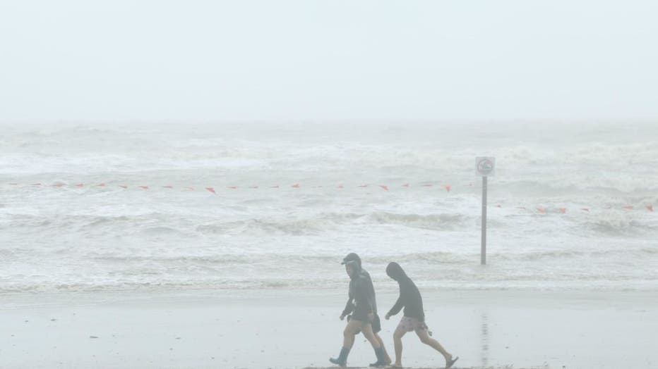
People walk on the beach at Galveston Island as tropical storm Beta will make landfall near Matagorda Bay on Sept. 21, 2020 in Galveston, Texas. (Zeng Jingning/China News Service via Getty Images)
Rainfall totals through Friday will be between 1 to over 3 inches, especially in extreme north Georgia. Some areas along and south of Interstate 20 might not even receive an inch of rain. Given how much rain we've had this month, hopefully the lower rainfall projections will verify.
Also, we are not forecasting washout conditions Thursday and Friday, but at times, the moderate to heavy rain could linger for a longer period of time.
Even though we're forecasting high rain chances with more cloud cover, temperatures will be warmer especially by the weekend with highs near 80 degrees.
Keep up with the latest by downloading the FREE FOX 5 Storm Team app and following @FOX5StormTeam on Twitter.