Top-secret US aquatic military vessel spotted on Google Maps

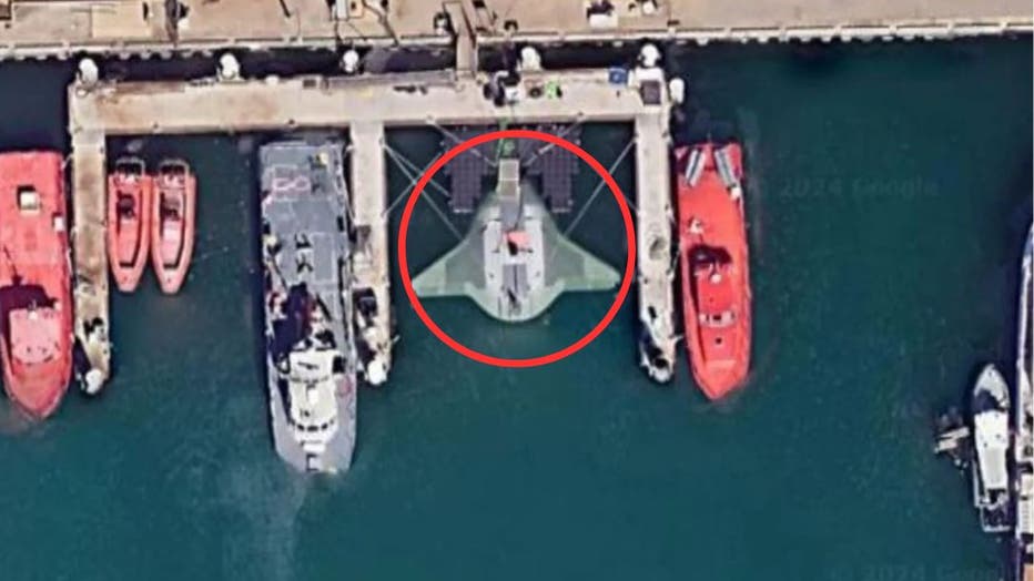
The "Manta Ray" aquatic defense vessel was spotted docked at Port Hueneme in California on Google Maps. (Northrop Grumman | Google Maps)
A top-secret submarine prototype has been identified on Google Maps images by sharp-eyed users who spotted its futuristic design and quickly spread the word, the New York Post reported.
Photos showing the "Manta Ray" autonomous vessel apparently docked at Port Hueneme naval base in California went viral Sunday as military and aeronautical buffs gawked at the rare glimpses.
The submarine is named after the marine creature due to its physical similarity and ability to lurk for extended periods deep underwater.

The "Manta Ray," a U.S. submarine prototype, remains visible on Google Maps while docked at the Port Hueneme naval base in California. (Google Maps)
The brainchild of Northrop Grumman, the vessel is part of a wider U.S. Navy project to augment the nation's long-range underwater fleet of unmanned vehicles.
The Manta Ray was tested off the coast of Southern California for several months earlier this year.
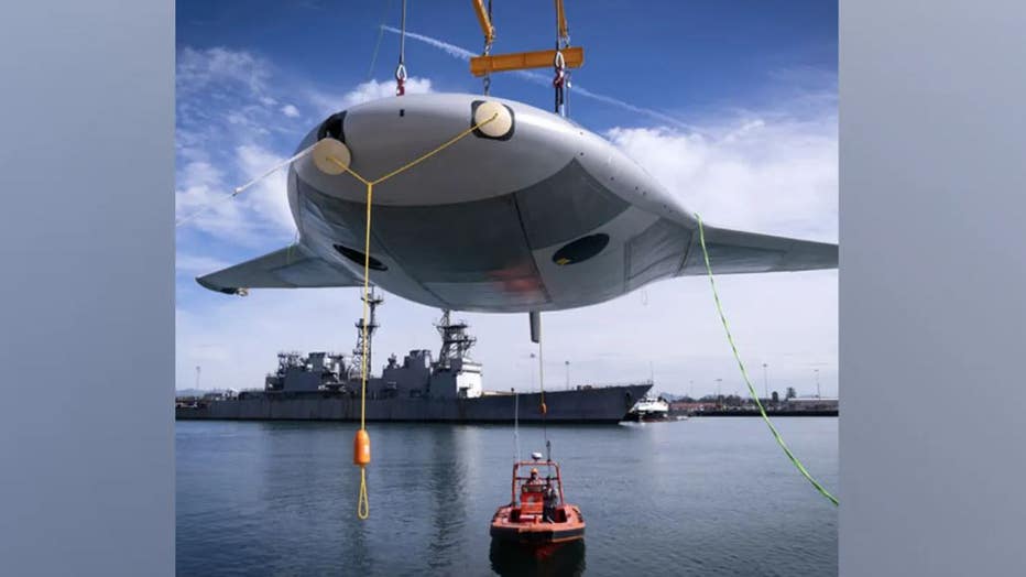
The defense giant released photos of the vessel showing it gliding underwater.
Dr. Kyle Woerner, program manager for the Defense Advanced Research Projects Agency, said the submarine can remain on the sea floor for long stretches without the need to refuel.
"Our successful, full-scale Manta Ray testing validates the vehicle’s readiness to advance toward real-world operations after being rapidly assembled in the field from modular subsections," he said in a statement.

The "Manta Ray" submarine is hoisted into the water. (Northrop Grumman)
Woerner also extolled the Manta Ray's ease of assembly in limited spaces.
"Shipping the vehicle directly to its intended area of operation conserves energy that the vehicle would otherwise expend during transit," he said.
The agency is working with the military to schedule further testing and to plot out potential future uses for the vessel.
Industry experts believe that the Navy is prioritizing the development of drone technology to keep pace with Russian and Chinese advances in the field.

