This browser does not support the Video element.
Life-threatening flooding pummels Tennessee, Kentucky
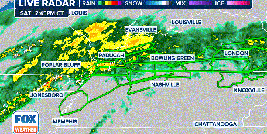
Water rescues have been reported in western Tennessee and southern Kentucky as more than 3-5 inches of rain fell by Saturday afternoon with more on the way.
Life-threatening flash flooding swept across parts of Tennessee and Kentucky on Saturday as a potent storm produced a myriad of threats across the Eastern U.S.
Numerous reports of impassable roads dotted the map in western Tennessee and into southern Kentucky, where rainfall reports climbed over 3-5 inches as of during the first half of the weekend with more rain still to come.
Dozens of Flash Flood Warnings were issued amid a Flood Watch tagged with the more dire "Particularly Dangerous Situation" designation as torrential rains fall on ground already saturated from previous soaking rain events of the past week.
In Corbin, Kentucky, flood waters carried a truck off a road and into nearby ditch, according to a storm report from the National Weather Service office in Jackson, Kentucky.
Near Lewisburg, Kentucky, swift water rescue teams were needed to rescue a driver who became trapped in swift waters of the swollen Mud River, the NWS reported. Another water rescue was needed to the west in the town of Murray.
A driver also became stranded in floodwaters in Martin, Tennessee, another NWS spotter reported. Scottsville, Kentucky reported "numerous roads are impassable," and spotters in Monticello, Kentucky reported a stretch of Highway 90 was closed due to an 8-foot deep sinkhole.
In Richland, Kentucky, the fire department was called to rescue four people and their pets who were trapped in their flooded home.
City officials in Clarksville, Tennessee posted multiple photos of flood-covered roads around their town.
"We're going to see a number of rockslides, a number of landslides, a number of mudslides and debris flows in eastern Kentucky due to the tremendous about of rain that we're going to pick up the rest of (Saturday)," says FOX Weather Meteorologist Michael Estime.
Flooding even stretched into southwestern Virginia, where Gov. Glenn Youngkin says he's deployed the National Guard among other first responders to the area.
NOAA's Weather Prediction Center has now issued their most dire level 4 flash flood threat rating of "extreme" for parts of northwestern Tennessee and southwestern Kentucky.
"There's so much moisture available and it's going to continue to get pumped in from the south throughout the day," FOX Weather Meteorologist Ari Sarsalari said. "This is the real problem here – 1 to 2 inch per hour rain rates. That's a that's an extreme rate of rain. So it's going to be falling so heavily, the creeks and streams start to get overloaded. And then all of a sudden, before you know it, you've got catastrophic flooding going on, which is definitely a possibility today."
High risks are only issued on about 4% of days, but this risk category accounts for 39% of flood-related fatalities and 83% of flood-related damage in the continental U.S., according to research by WPC meteorologists. About half of such alerts result in at least one death.
A Level 3 out of 4 risk for flash flooding expands farther out into the Ohio and Tennessee Valleys as potential exists for numerous flash floods, some of which could be significant.
Flood Watches have been issued that extend over 900 miles from Arkansas to Pennsylvania. About 11 states are included under these.
Read more of this story from FOX Weather.