

Timing out Sunday's storms: When to expect heavy rain, lightning across Metro Atlanta
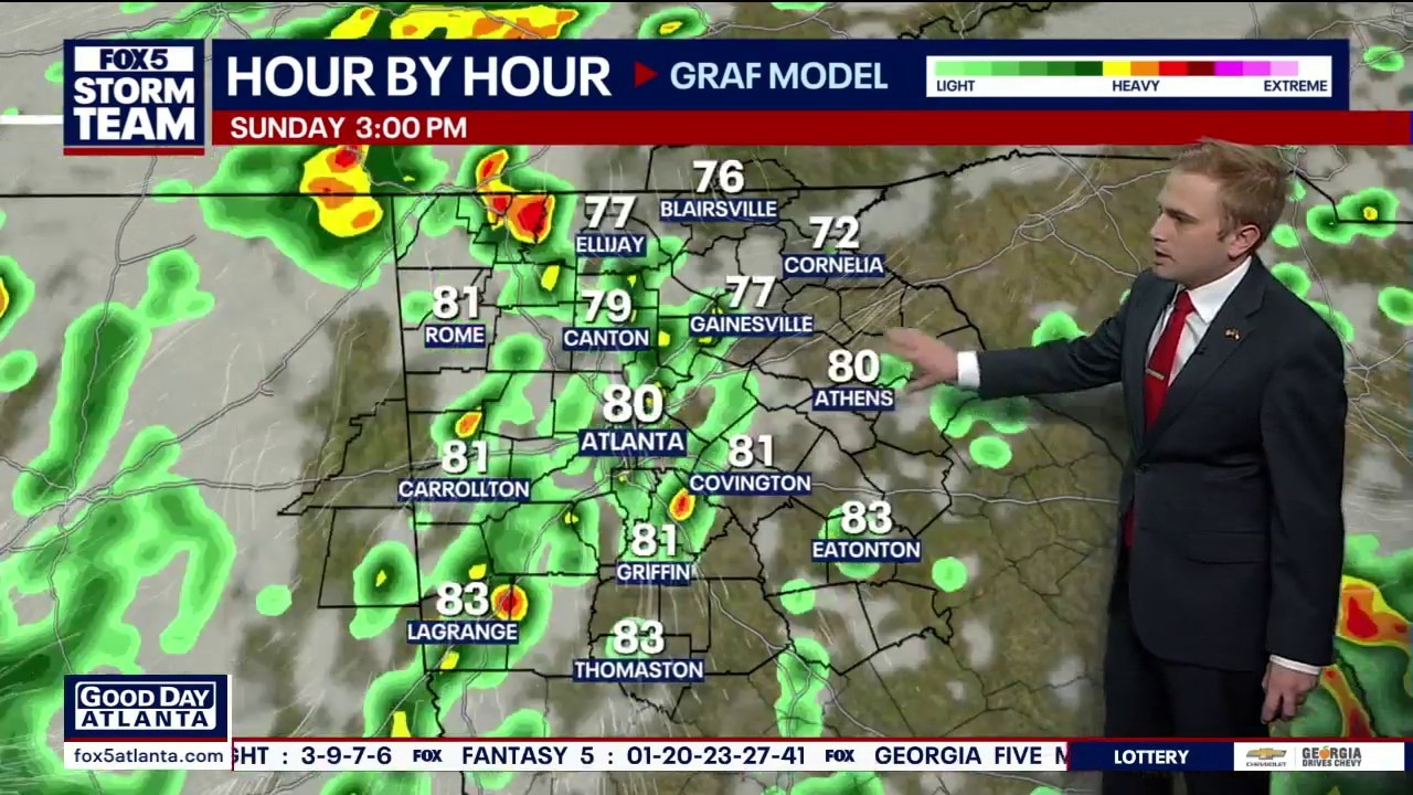
Sunday morning weather forecast
FOX 5 Storm Team Meteorologist Alex Forbes says to expect showers and storms on Sunday and Memorial Day.
ATLANTA - Multiple rounds of scattered showers and isolated storms are moving through North Georgia, driven by heavy Gulf moisture that has settled over the Southeast. While the rainfall is much needed, forecasters warn that heavy downpours arriving all at once could trigger isolated flash flooding across the region.
Sunday will start cloudy and mostly dry before a fresh round of isolated storms develops during the afternoon and evening hours.
Afternoon storm timing and severe threat
What we know:
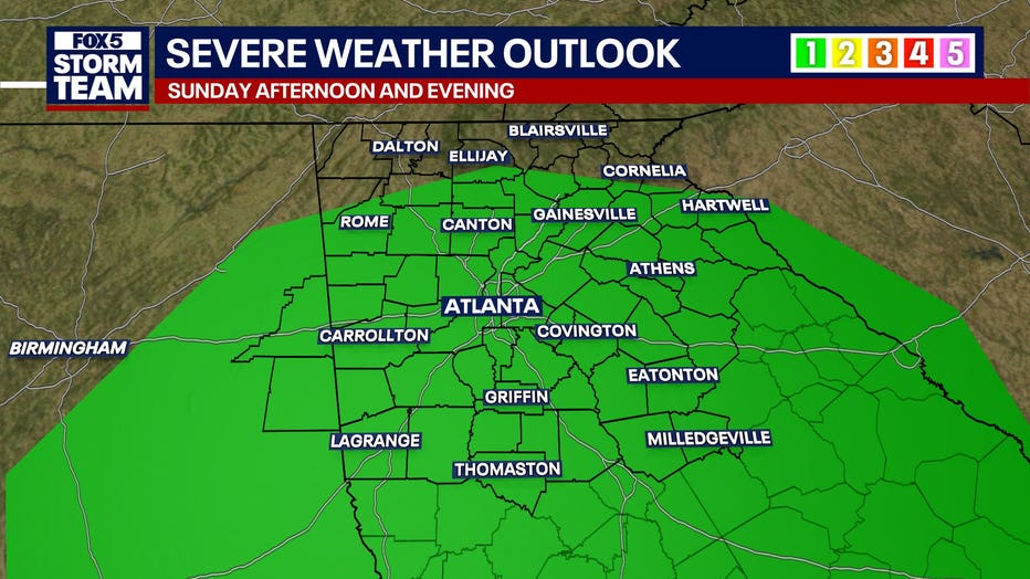
Widespread shower and storm activity will pick up in the afternoon and continue beyond. These storms bring the potential for locally heavy downpours that could rapidly increase rainfall totals in a handful of places. This follows severe weather from the previous day, where Fulton and Cobb counties recorded nearly a half foot of rain directly along the Chattahoochee River.
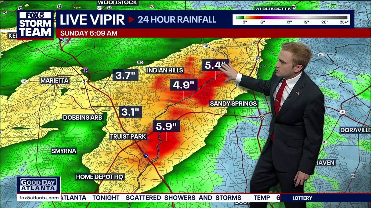
Nearly a half-foot of rain Saturday near Sandy Springs and East Cobb
FOX 5 Live Vipir estimates nearly 6" of rain in the Northside and New Northside Drive areas. 4+" totals extended north toward Johnson Ferry and Lower Roswell Roads.
The primary severe weather threat is ranked at a Level 1, positioned mainly in the central and southern portions of Georgia. Impacted areas include parts of Upson, Monroe, Jones, and Baldwin counties through the afternoon.
The region faces a decent chance of rain through Sunday, Monday, and Tuesday. While the precipitation will slack off a bit through the middle part of the week, the best overall opportunities for rainfall remain concentrated across these four consecutive days.
Sunday and weekly forecast timeline
Timeline:
- Sunday Morning: The day will start with lingering cloud cover and mild morning temperatures in the middle 60s. A few stray raindrops cannot be ruled out, but overall morning rainfall will remain very light.
- Sunday Midday: The region will experience a split setup; some areas will catch brief windows of midday sunshine while other locations experience light showers.
- Sunday Afternoon and Evening: A fresh round of isolated storms will develop. While these storms are not expected to build to severe levels, they will bring a renewed threat of heavy downpours, intense lightning, thunder, localized flooding, and gusty winds. The system will gradually clear out late Sunday night as it tracks northeast into the Carolinas.
- The Week Ahead: North Georgia is locked into a highly repetitive weather pattern over the next several days. Expect daily afternoon highs to peak in the middle 80s, with overnight lows holding in the upper 60s. Daily opportunities for scattered showers and isolated storms remain in the forecast, though storm chances will begin to wind down slightly during the second half of next week.
The Source: The information in this story was gathered from a FOX 5 Atlanta live weather broadcast by FOX 5 Storm Team meteorologist Laurann Robinson, detailing live Viper Radar tracking and the severe weather outlook updated on May 23, 2026.